Last updated on May 7, 2026
There Be Geologic Oddities…
This post will be updated as time allows.

Cactolith
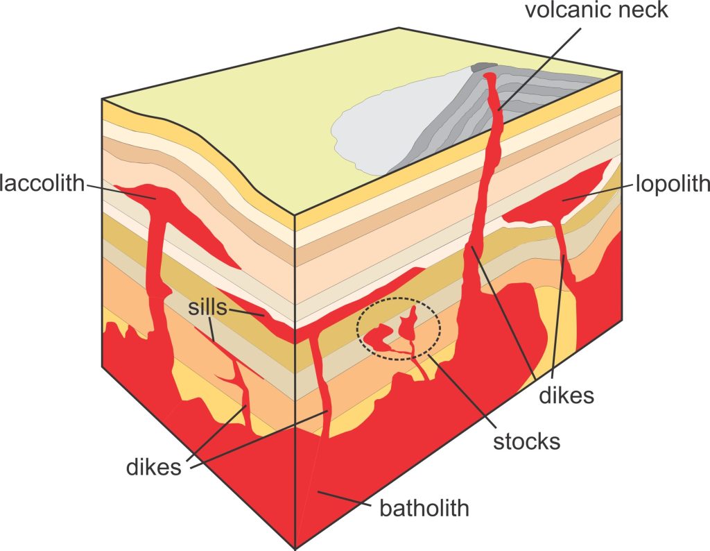
Cactolith — a quasi-horizontal chonolith composed of anastomosing ductoliths, whose distal ends curl like a harpolith, thin out like a sphenolith, or bulge discordantly like an akmolith or ethmolith.
Haha!
This term was introduced by USGS researcher Charles B. Hunt in his 1953 publication, “Geology and geography of the Henry Mountains region, Utah.” Although he was describing a geological feature that genuinely looked like a cactus, Hunt later clarified that the term was a deliberate absurdity, meant to satirically highlight the convoluted naming conventions geologists were developing for variations in intrusion shapes.
Additional obscure, irregular, mostly obsolete igneous intrusion terminology, some of which was used by Hunt in his satire definition of a cactolith:
akmolith (ak’-mo-lith) — a form of discordant pluton that bulges upward.
ductolith (duc’-to-lith) — a more or less horizontal igneous intrusion that resembles a tear drop.
chonolith (cho’-no-lith) — an irregular, non-tabular shape.
ethmolith (eth’-mo-lith) — discordant, funnel-shaped pluton which tapers downward.
harpolith (harp’-o-lith) — sickle-shaped igneous intrusion injected into deformed strata.
lopolith (lop’-o-lith) — layered igneous intrusion having a convex-down roof or floor.
sphenolith (sphe’-no-lith) — wedgelike igneous introusion, both partly concordant and discordant.
phacolith (phac’-o-lith) — concordant, lenticular, sill-like intrusion found along a fold axis.
Sources:
Glossary of Geology, Fifth Edition, Revised. American Geosciences Institute.
Toreva
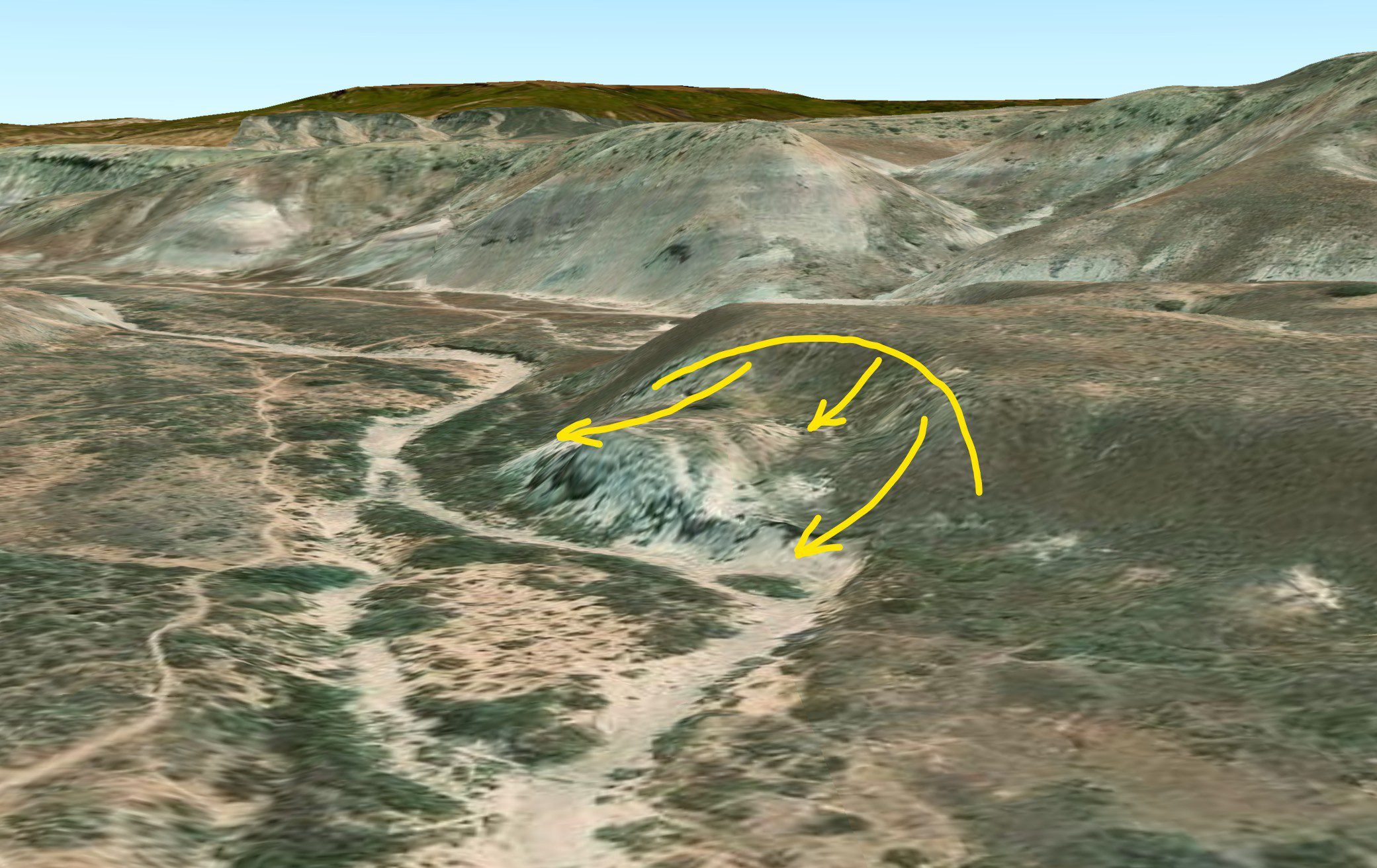
Toreva (To-re’-va) — A slump block consisting essentially of a single large mass of unjostled material which, during descent, has undergone a backward rotation toward the parent cliff about a horizontal axis that roughly parallels it (Reiche, 1937). See also: rotational landslide.
Source: Glossary of Geology, Fifth Edition, Revised. American Geosciences Institute.
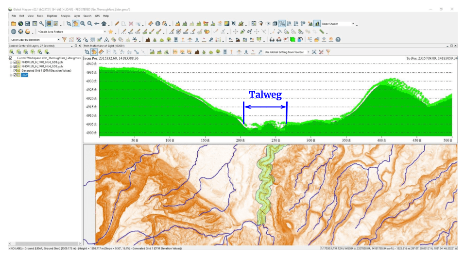
Graphic created by Bristlecone-Geo, 2025.
Talweg
Talweg [Geomorphology] — (a) The line connecting the lowest or deepest points along a stream bed or valley, whether under water or not; the longitudinal profile of a stream or valley; the line of maximum depth. Syn: valley line. (b) The median line of a stream; the valley axis. (c) channel line.
Etymonology: German, old spelling “Thalweg” (now “Talweg”), “valley way”. Pronunciation: [taal-vehk].
Source: Glossary of Geology, Fifth Edition, Revised. American Geosciences Institute.
Yardang
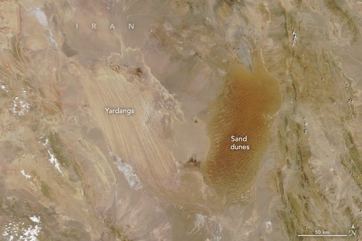
Yardang — a large area of soft, poorly consolidated rock and bedrock surfaces that have been extensively grooved, fluted, and pitted by wind erosion. The rock is eroded into alternating ridges and furrows essentially parallel to the dominant wind direction. The relief may range from one to several meters, and there may be unconnected hollows and other irregular shapes. Yardangs occur in various deserts of the world including the Turkistan and the Mojave deserts.
Source: NASA Earth Observatory

Tafone
Tafone (ta-fo’-ne) [Geomorphology] — (a) A Corsican dialect term for one of the natural cavities in a honeycomb structure, formed by cavernous weathering on the face of a cliff in a dry region or along the seashore. The hole or recess may reach a depth of 10 cm, and is explained as due to solution of free salts in crystalline rock (granite, gneiss) following heating by insolation. (b) A granitic or gneissic block or boulder hollowed out by cavernous weathering. Pl: tafoni.
Source: Glossary of Geology, Fifth Edition, Revised. American Geosciences Institute.
Discover more from Bristlecone-Geo
Subscribe to get the latest posts sent to your email.